
Forward: Heinz W. Pyszczyk
Canada’s western rivers served as the major inland travel routes for the 18th and 19th-century fur trade. Then, later, their banks were covered by prairie cities – Edmonton, Calgary, Medicine Hat, Saskatoon, and Prince Albert.
The distances the early traders travelled in their flimsy-looking, but effective, birch bark canoes were legendary. Imagine, along with your seven companions, starting at the Grande Portage on Lake Superior. For the next 40-60 days you paddle 40-45 strokes per minute, first downstream, then upstream, to reach Fort Edmonton. Hopefully, you will arrive, after covering over 1,600km, before freeze-up.
Last summer, Mike Donnelly canoed one of these rivers. Unlike the early traders, his was a shorter, less strenuous, solo adventure. Mike set his canoe in on the Bow River near Bassano, Alberta, Canada. He canoed east down the South Saskatchewan River. Finally, after 41 days, he ended his journey east of the Forks of the Saskatchewan. The distance following the river, if driven by car, is nearly 700km. By canoe, it’s 1,228km.
Here are a few stories Mike collected on his travels. The numbers on the map below correspond to the numbered places on his photographs and titles.

Postcards From the Saskatchewan: Mike Donnelly

“The Prairie proper ends at Calgary, among the cattle-ranches, mills, breweries, and three million acre irrigation works. The river that floats timber to the town from the mountains does not slide nor rustle like Prairie rivers, but brawls across bars of blue pebbles, and a greenish tinge in its water hints of the snows.” (1907, Rudyard Kipling travelling west on the CPR) 1
I put the canoe in two hours east of Calgary, below the Bassano Dam. The Bow no longer brawls over pebbles here, but slides and rustles like a prairie river should. I didn’t step onto a sand bar for ten days; not until the Alberta border, at the Forks, where the South Saskatchewan and the Red Deer Rivers meet. Until then, it was just sticking, slipping, sliding, squishing—mud.

The drilling crew struck gas in January of 1909. They called the well Old Glory. It was the largest producer in the country and the beginning of the Bow Island Gas Field. By 1912 a pipeline was completed running 170 miles 2 up to Calgary, and 12,000 people gathered on a summer’s evening to watch the lighting of the inaugural flare. 3
Gas Town had been just upriver from where I was camped; a little village of company workers and their families. By the 1930s, there was a double row of houses, vegetable gardens, green lawns, and hedgerows. There’s nothing there now, just prickly pear and prairie grass. Setting up camp, I had to watch where I stepped, and still ended up pulling a few cactus spines from my foot. The wind began after midnight and was soon battering the walls of the tent. By morning, all was calm again.

It was a cow that woke me up. It woke me from my bent-up, mid-afternoon siesta in the bottom of the canoe where I’d grounded along the shore. I lifted my hat and looked down at the bleached exoskeleton of a dead crayfish just under the water. I looked around, there was no cow, it was dream-cow, I was starting to dream cows now.
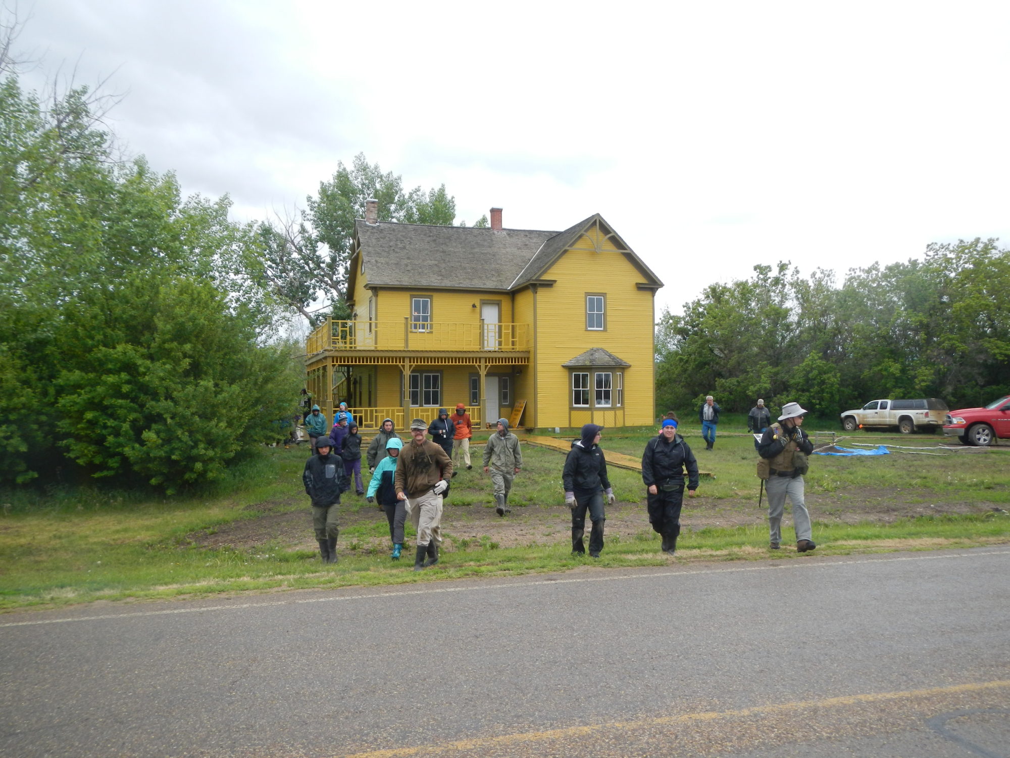
Later, I was told this ruin was the old Wallwork ranch house. They had come east from Lethbridge and, before that, England. In photographs, Nathan has the confident mien of a riverboat gambler. Rachel looks like a sturdy and imposing woman. She’s draped in a long dress with ruffled sleeves. A wide hat, like a fancy gateau, sits perched atop her head.
In the spring of 1903, a railway car carrying all their possessions was dropped in the siding at Cherry Coulee—a lone box car on the open prairie. Everything (including an organ, for Nathan was an accomplished pianist) would be unloaded and carried by wagon down to their new home by the river.
I picked up the handle of a porcelain cup. In the next room the floorboards were falling through to the cellar and canvas scraps, still clinging to the walls, fluttered in the breeze. Outside in the grass, I stepped over the bottom of an old shoe and kicked at a tin can. Rusted bed springs had been stuffed down the well. Kingbirds chattered and flitted from the cottonwoods to the sagebrush and back again.

I watched the old green bus drive away, ‘Watch More Sunrises’, counseled the bumper sticker. I’d lost my wallet, and now my ride into town. The family was from a northern Ontario railway-turned-lumber-turned-mining town. There were solar panels on the roof, four bicycles hung from the hood, and inside was a full fridge, home-made cabinets, a table, and bunkbeds. Dad pointed at the passenger seat, “Found that at the dump, it’s from one of those three-wheelers for handicapped people.” They seemed real nice. I was sad to see them leaving without me.
Later, after having found my wallet, my way into town, and stocked up on supplies, I took a taxi back. Debbie, driving, pointed out the historic barn with its rounded gambrel roof, white clapboard, and brown trim:
“I had to paint that barn one summer, as punishment.”
I assumed underage drinking.
“No, I hit my sister in the mall.”
“And your parents punished you?”
“No, the cops saw. The judge was hard on me; he also gave me a $500 fine.”
“Wow, you must have really decked her.”
It was 37 degrees out, the small lake was full of kids, and there were signs warning of Swimmer’s Itch. I walked a mile back to the campground and followed my shadow the entire way.

The crickets buzzed all afternoon. In the middle of the river I passed a rattlesnake; head up and sidewinding its way over the brown, choppy water. By six o’clock, I had tied up at the ferry landing, a 54-kilometre day. The guys at the last ferry had called ahead and warned of my approach. Dinner was ready: corn on the cob, homemade sausages from the air-fryer, and a beer. Our phones all sounded the alarm at the same time:
“Emergency Alert. Severe Thunderstorm Warning, 8:08 p.m. DESTRUCTIVE WINDS in this mobile coverage area. Take immediate cover in a basement or interior room if weather threat approaches. Shelter from flying debris if outside.”
I sheltered in the Ferrymen’s shack. There was nowhere else to go. Back to the Future was on the T.V. and the rain came down hard on the roof. We missed the worst of it, and the dark clouds soon passed away to the southeast, while the mosquitoes reappeared.

It was just after 9 am, and with the tickle of a breeze behind my ear, I raised the sail. It wasn’t much, but I was moving. Soon enough, I was becalmed again. This was usually the case, or else the wind was in my face. Which was fine, I guess; I had been told stories about the wind and waves on Lake Diefenbaker. Leaving the town of Elbow at the head of the lake I passed a man on the beach with his dogs: “You picked a good week, these last six days. Usually, it’s windier than hell out here!”
I missed the cows and the beavers. I missed the talkative kingbirds, the nighthawks, the herons, and the soft sighs of the doves in the cottonwoods that lined the riverbank. There were no more robins, or peewees, or warblers. This was a 200-kilometre-long reservoir; there was no riverbank, there were no trees. Perhaps the songbirds had all flown south anyhow. Most of all I missed the current. At noon, I went for a swim—It was hot, hot, hot. Then I crawled ashore like a castaway, dragged myself into a tumbledown lean-to made of driftwood, and hid from the sun.

The breeze was out of the north and carried the hint of forest fire. The crickets were waking up, and a catbird mewed from the caraganas. There were starlings perched on the cross atop the steeple, pigeons strutted along the roofline, and flapped in and out of the gaps in the louvered shutters. The Church of the Immaculate Conception—Prairie Gothic. Father Brueck spent the summer of 1900 travelling, living in a tent, and ministering to groups of Métis and Galicians (Poles and Ukrainians). By winter, they had built him a log shack. In a letter to his superior, he wrote:
“Last Sunday I celebrated mass for the first time in the chapel. It is far from being finished. Roughly plastered with mud, it looks more like a barn than like a chapel residence. But our Lord did not disdain a stable at his birth.”
The church was built the following year. In 1920 it burned, was rebuilt, and then closed permanently in ‘57. To put off vandals, Jack Bozowski bought the church and the land. He planted wheat up to the walls and was quoted as saying,“If people do not respect old buildings there are still some who respect a crop of grain.” 4

“The men were all French Canadians with long red or blue caps, half of which hung down the head; they wore grey capots, or blanket coats, belted round their waist, their trowsers of grey cloth or dressed leather, and their shoes of the same. Our dresses were a coarse hat, tight blue jacket with leather trowsers and shoes, to which in winter was added a leather coat. We now cleared the ground to build a log house of thirty six feet in length by twenty in breadth, which when carried up to seven feet in height, was roofed with split logs, the ridge pole was placed on two upright Logs of twelve feet and gave to each side a slope of five feet. The whole was mudded and covered with earth.” (the building of South Branch House, from David Thompson’s, Travels) 5
The four canoes of HBC men arrived on the 28th of September, 1786. 6 A young Thompson spent the winter here, working as a clerk. Eight years later, South Branch House was pillaged, burned, and never rebuilt.
As I approached, the crows were streaming from the tops of the aspens that lined the high bench, flying away to the south. A ruckus of black birds. I counted one hundred, two hundred. The bank was steep, and I had to scramble up (and returning, fell my way down). The trees were still green, but the dogwood willows were a deep red, and the chokecherry leaves were turning to rust. The berries were ripe: black, sweet and furry on the tongue. An oat field of golden stubble stretched away to the east.
The bench led down to a flat, and in 1885, this was known as Gariépy’s Crossing. There is a photo of Riel taken here at General Middleton’s camp, following his surrender in the days after Batoche. He stands with his hands in pockets against the corner of a canvas tent, perhaps talking with someone out of frame. Bearded, dark vest, battered cowboy hat. He seems at ease. The soldiers stand a polite distance away with the river behind. Six months later, he was hanged.

“One had to pass through the French settlements, after these sad events, in order to fully perceive the mourning and desolation that reigned there. I went to St. Louis around that time and, even if the enemy had not passed through there, even if there were no incinerated houses, the sight of all those sad and dejected faces, of those widows whose husbands were dead or in exile, of those wounded, lying inert and in pain, gave me the most intense impression of sorrow. And all these people had hardly any food left.” (Louis Schmidt) 7
It was 52 days by ox-cart from Red River when the first large group of Métis settlers arrived here in 1882. In 1870 Louis Schmidt had served as Riel’s personal Secretary in the Provisional Government at Red River. By 1885 he was working as an Agent of Lands in Prince Albert. He supported the Metis grievances but took no part in the rebellion:
“He condemned the recourse to arms and apostasy of Métis who had followed Riel in his heresy.” 8
As I paddled towards the bridge, I could make out, ‘CAR WASH’ through the tree tops, in bold, red-faded letters. On the far side of the river was a tumbledown yard and a barking dog. It felt humid and swampy. I pulled in to shore and spooked a flock pigeons out from under the bridge. A group of wading yellow-legs pew-pew-pewed away across the water. I was hoping to stop in at the old riverside hotel for a drink and something to eat. I’d sit with my elbows atop the well-worn countertop, and the bartender would ask, “You come up from the river?” (A canoe-trip is currency in any conversation.) Then, I would ask about the story of the Ghost Light of St. Louis. A Pepsi sign still hung out over the front door, but the hotel was closed. A crushed-gold-velvet swivel rocker sat out front on the sidewalk. It looked like it had been closed a long time. I never did get the story.

I sat cross-legged at the tent door and watched as one star appeared, and then another. I looked away, and when I looked back again the northern lights had come—soaring, needle-like columns that hung low over the water—pale-green and luminescent. A curtain of glowing light that drifted and shapeshifted across the eastern sky. Then, after twenty minutes they were gone.
This was the time of the Goose Dance, Niskisimowin, of the Muskego (the Swampy Cree of the Hudson Bay lowlands and the lower Saskatchewan). 9 The traders called it the Rendezvous. 10 It occurred in the spring and the fall, at gathering places along the river, with days of feasting, dancing, and ceremony.
“Each spoke addresses to Kitche Mantiou (The Great Spirit), thanking him for the gifts of food and supplies to his Indian children. Each of the winds were given a smoke by presenting the pipes to the four quarters of the compass. Then with a stately walk around the old men retired. The tomtoms struck up and four young girls came dancing into the ring each with a bag of down of fine feathers. Keeping time to the music as they circled, a bunch of down was placed on each visitors head. There was a pause and then bang went the tomtoms at full speed.” (Reginald Beatty, Hudson’s Bay Co. trader, 1870s) 11
It was my final morning and I paddled for five hours in the fog, sometimes unsure if I was pointed upstream or down. I heard wolves; a long, low howl that carried across the water, followed by another. Ten minutes later I rounded a bend and they started up again, all of them, right there, somewhere, in the fog and the spruce along the riverbank. A descending chorus of howls and song. And then suddenly, silence.
Footnotes:
- Kipling, Rudyard. 1920. Letters to Family, from Letters of Travel: 1892-1913. Doubleday Page & Co. New York, pg. 197.[↩]
- Bow Island Review. July 19, 1912, pg. 1[↩]
- Petroleum History Society Archives: November 2002; Vol XIII, No. 5.pg. 2.[↩]
- Lavigne, Solange. 1990. Kaleidoscope – Many Cultures, One Faith : the Roman Catholic Diocese of Prince Albert, 1891-1991. Diocese of Prince Albert, pg. 193.[↩]
- Hopwood, David, Editor. 1971. David Thompson – Travels in Western North America 1784-1812. Macmillan of Canada, Toronto, pg. 86.[↩]
- Moreau, William E. Editor. 2009. The Writings of David Thompson, Vol I. The Champlain Society, pg. 53.[↩]
- Lavigne, Solange. 1990. Kaleidoscope, Many Cultures-One Faith – The Roman Catholic Diocese of Prince Albert 1891-1991. Published by the Diocese of Prince Albert, pg. 170.[↩]
- Lavigne, Solange. 1990. Kaleidoscope, Many Cultures-One Faith – The Roman Catholic Diocese of Prince Albert 1891-1991. Published by the Diocese of Prince Albert, pg. 514.[↩]
- Meyer, David. The Goose Dance in Swampy Cree Religion. The Journal of the Canadian Church Historical Society. Vol. XXXII No. 1. April, 1991, pg. 107.[↩]
- Meyer, David & Thistle, Paul C. Saskatchewan River Rendezvous Centers and Trading Posts: Continuity in a Cree Social Geography. Ethnohistory, Vol. 42, No. 3. Summer, 1995, pg. 403.[↩]
- Meyer, David. The Goose Dance in Swampy Cree Religion. The Journal of the Canadian Church Historical Society. Vol. XXXII No. 1. April, 1991, pg. 111.[↩]


