

In my last post I used historic documentary records to search for lost early Euro-Canadian fur trade establishments in the remote, dense northern forests of Alberta, Canada. In this post I discuss other ways we might be able to find archaeological remains hidden beneath our feet.
Infrared Photography, Magnetometer Survey, Ground Penetrating Radar, LIDAR. Archaeologists use these non-invasive techniques to find archaeological remains hidden in remote parts of the world or where any archaeological surface evidence has been obscured by construction or other ground surface disturbance. Some methods work better than others in certain conditions. They, however, can also be misleading and potentially destructive if not used properly.
First Some Extreme Examples of Non-Invasive Search Methods
While most of the above techniques have merit, others are a little more far-fetched. In 1975 I attended my first CAA (Canadian Archaeological Association) Conference in Thunder Bay, Ontario. It was pretty cool meeting and listening to all these learned people so passionate about archaeology.
As the liquor flowed freely so were the more outlandish ideas on how to find archaeological sites without, you know, all that work (walking and stumbling around in the bush, digging endless test pits). At one of the evening receptions I noticed a bunch of people gathered around a table intently watching as two archaeologists were dangling a string with something attached to the end over the map.
I casually walked over, curious to see what they were doing. Maybe they were demonstrating some new archaeological technique that I should know about. What I saw however, surprised me. One of the archaeologist was dangling an arrowhead tied to a string over a map of southern Ontario, while the other was taking notes. I couldn’t believe what I was seeing. Dousing for archaeological sites or remains using an arrowhead on a string. Apparently the arrowhead would point to a place on the map suggesting archaeological remains were buried there.

Welcome to the world of some of the more outlandish methods ever used in archaeological detection, Heinz. You might have just hit an all time low. Wow! Could these learned people be serious? It seemed so. And some of those gathered around the table also seemed convinced this method might work.
…………………
I should not have been surprised that people would use the paranormal in archaeology to help them in their investigations. Throughout the history of archaeology paranormal examples abound. Google it and you will see. Often referred to as psychic archaeology, or Psychometry, most of its claims are of a dubious nature.
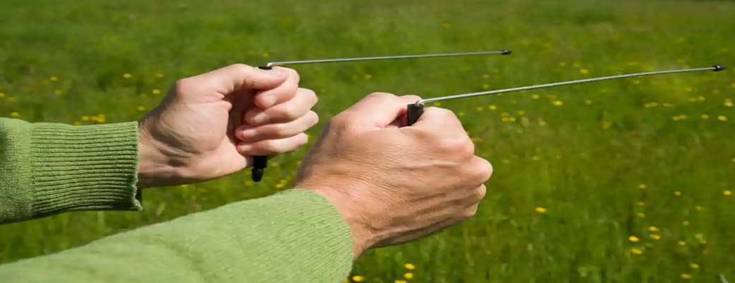
In fact, it was earlier in 1974, while at my first archaeological dig at the HBC Fort Victoria, Alberta, that I was introduced to another somewhat unorthodox method of archaeological detection. Dowsing.
Dowsing (Divining, Witching) is a method whereby a person holds and forked branch or coat hangers and walks over the ground surface to detect features objects hidden beneath. Originally it was mainly used to find water (and still is) but is also applied to many other fields of detection. Including archaeology.

So we tried walking over the fort cellar depressions and palisade footer trenches holding two bent coat hangers. They were supposed to cross when you hit a buried feature. Some of the students believed it worked. Others did not. I was amongst the latter.
Even to this day, one of my colleagues (who shall remain anonymous) and I have had a 40-year debate about the merits of this technique. I’m a skeptic of any method not based in science. Others, like my colleague, are more liberal thinkers I guess. Apparently this method is supposed detect magnetic anomalies under the ground surface. That supposedly is the scientific connection. As you will read shortly not even sophisticated equipment capable of accurately measuring the earth’s magnetism are able to make that connection.
My strangest encounter (so far), while excavating at the last HBC Fort Edmonton, was with a woman who claimed, once she had held a piece of jewelry we found, it belonged to her distant relative who worked at the fort. We thanked her for her insights but did not pursue the matter any further. With this Psychometric method one holds an ancient artifact which will then send messages about its history. This method too has not gained much traction over the years among my colleagues. Nor among thieves.
Although I must admit the use of psychic archaeology is tempting when things are not going as they should in the field. My future wife and I, while at Fort Victoria in 1974, tried channeling (of sorts) one night. We tried calling up the ghost of the Clerk in charge of the fort, a Mr. Tait, I believe. We entered the old clerk’s quarters (built in 1864 and still standing on the site) at midnight. After a lot of shouting and pleading for answers we only managed to wake up a few people and totally scared ourselves in the process. I think there was liquor involved in that episode as well.

Metal Detecting. Night hawking, as it is often referred to which, as one archaeologist put it, has had a love-hate relationship with archaeology. Yes, you can find ferric objects with this method, if that’s all you wanted to find. Even major treasures as have been recently found in England with this method. And then you rip those objects out of the ground without any proper context or worse not even recording their location. Unless palisade and building walls are made of iron, finding major archaeological features with this equipment is also problematic.


Some Slightly More Refined Non-Invasive Search Techniques
Some non-invasive search methods have proven better than the aforementioned. But nearly all have their limitations which, if not recognized, could create more problems than solve.
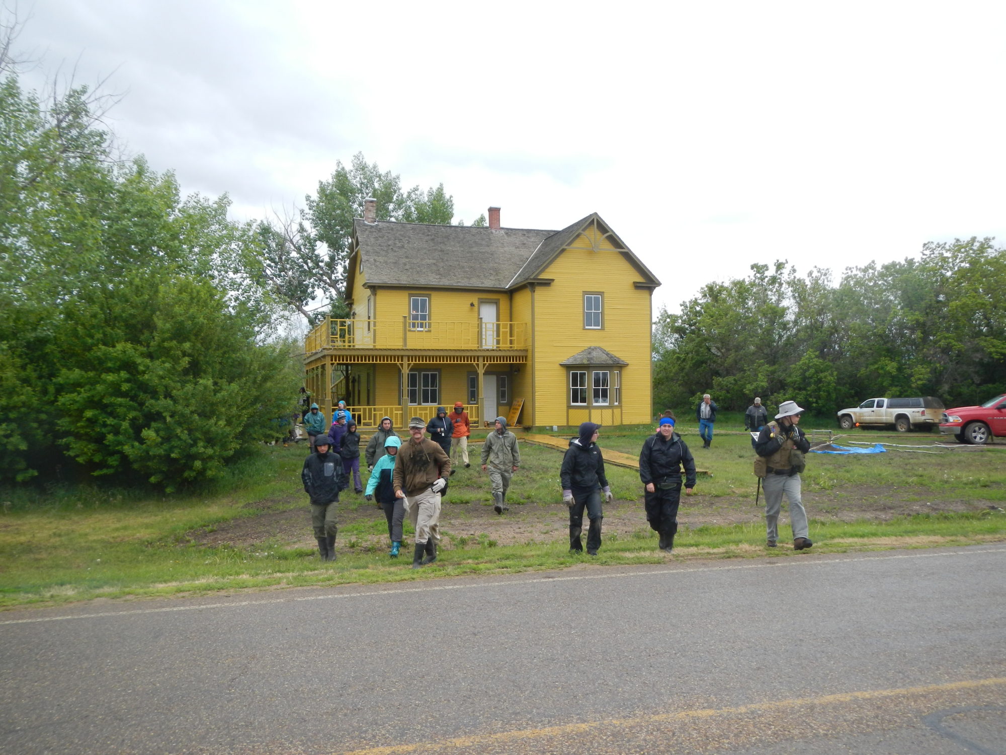
When I search for historic archaeological sites, I observe the surface of the ground carefully when looking for either features on a site or the site. While some features, such as large depressions or mounds are pretty obvious, more subtle features still leave surface evidence even after hundreds of years. After clearing the vegetation off the Fort Vermilion I site, in some places the fort’s original palisade trenches were still evident on the ground surface. At Fort Edmonton, where the ground had been totally landscaped and scrubbed clean of any surface fort evidence, the north palisade was evident as a slightly depressed line where the grass grew better.

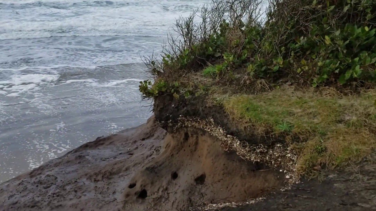
Not only does the ground continue to slump in these trenches, the soil chemistry and water regime may also change, affecting vegetation. I have seen shell middens representing prehistoric First Nations settlements on the Northwest Coast of Canada that are totally devoid of trees (in a rain forest) because both the soil chemistry and moisture regimes have changed.

Even normal aerial photography can produce some surprising results. For example, for years Parks Canada archaeologists could not find one of the missing Rocky Mountain House forts in central Alberta, Canada. Until one day, quite by accident, and luck, it appeared in a photograph.

The use of infrared and other types of photography sensitive to different wavelengths of light are also proving useful in archaeological discovery.

During the late 1970s while excavating at the NWC Fort George (c.1792-1800) archaeologists were testing a new non-invasive technique. Ground Penetrating Radar.
The earth is surrounded by varying amounts of magnetism. Physicists found that subsurface features, such as extensive burning, or buried materials, give off different rates of magnetism often associated with human activities. If such a technique proved effective, it could help detect features at an archaeological site, saving countless hours in searching with subsurface testing.
The method has proven moderately effective but the anomalies are sometimes very difficult to interpret and can be affected by modern intrusions giving off what we call false positives – an anomaly which turns out to be nothing or created by some modern intrusion.

While excavating Fort Edmonton V, we tried magnetometer survey, seismic testing, ground penetrating radar (GPR), and soil resistivity, to help find and better understand the subsurface archaeological remains. Some methods worked better than others.


GPR has its uses but is sometimes unreliable. Not only does it create false positives (finding little or nothing of consequence) but worse, false negatives (missing things of great consequence). Imagine if you will, using this method to detect all historic graves in an area, only to miss a few before the land is developed and built on. I have seen this method miss entire cellars big enough to hide a Volkswagon in. Whether the fault of the operator, or the method, caution must be taken. However, these methods are constantly improving, becoming more reliable for archaeological work.
…………………..
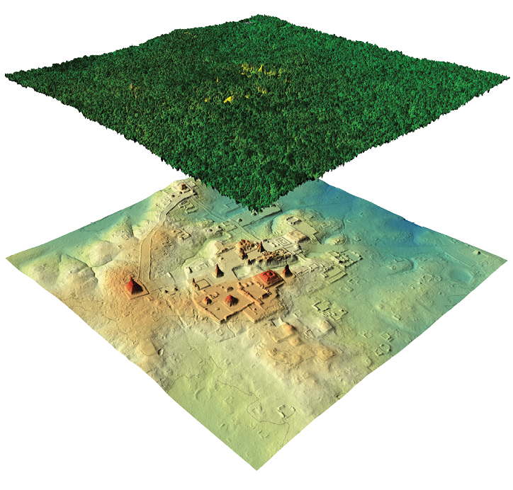
Light Imagery Detection and Ranging (LIDAR). This method was developed in the 1960s by the US Space Agency and then used in the Apollo 12 missions in 1971 to map the surface of the moon. The results were spectacular.
This method uses an optical remote sensing technique that can measure the distance to a target (in this case, the ground) by illuminating the target with light using pulses from a laser. It is sensitive enough to measure ground surface elevations even under dense forests. Here are a few examples of its use at archaeological sites and features having considerable vertical depth.


The problem with this technique, even today, is its cost. Presently in Canada there is little LIDAR coverage of the ground surface. Fortunately for us, Alberta Forestry Service had flown parts of northern Alberta with LIDAR, including the Fort Vermilion I area.
Here was an opportunity to test just how sensitive this method was in the thick northern boreal forests of Canada. We knew where the site was located. Also some of the surface features were fairly significant. They paled in comparison to the Mesoamerican settlements, but nevertheless this was an opportunity to carry out some controlled experimentation.


A Few Concluding Remarks
Inspiration for this post came when one of my readers casually asked about one of these non-invasive techniques. I replied that it was best not to get me started on that topic. Obviously, it got me started… I’ve had some good luck and some bad luck using these methods. And I firmly believe that with more experimentation and refinement they will become more reliable in the future.
We have come a long way from dangling an arrowhead over a map of Canada in hopes of finding archaeological remains. Or using coat hangers to dowse for buried archaeological remains. Some of the non-invasive search techniques are becoming more sophisticated and reliable, allowing us to detect archaeological history on a scale never imagined before.
But, occasionally I revert back to the old ways. I hoped for inspiration by sleeping in a tent on the old Fort Vermilion I site. Maybe I would receive a sign. To help me find things. And one night I received it when a pack of wolves accidentally walked onto the site sending off the most blood-curdling howling I have ever heard in my life. A message?
Beware the hazards of sleeping in remote places in Canada’s northern forests!
……………………..