
(The Chapter That Didn’t Make It)
Note: The author presented a version of this work as a keynote presentation at the 49th Annual Alberta Archaeological Association Meetings, Drumheller, Alberta, Canada, 2024.

“The prairies over which we travelled presented the same undulating, monotonous appearance.…To add to our discomforts on this day’s march, old Welsh, the guide, lost his bearings and led us miles out of the way. Indeed, for a considerable time we followed no track at all and were at the mercy of the Métis.” — Canadian Artist, Henri Julien, travelling west across the Canadian Prairies with the newly formed North West Mounted Police, 1874

While researching our recently published book, Cartographic Poetry. Examining Historic Blackfoot and Gros Ventre Maps, 1 I became interested in Indigenous wayfinding (the process or activity of ascertaining one’s position and planning and following a route) and navigation skills. 2 Compared to the Blackfoot, I realized that our current society has lost much of its natural ability to navigate through space. Where would we be without roads and signs, maps or GPS systems to guide us wherever we wish to go?
LOST!

If you wish to learn more about our book and its contents, and explore the details of how the Blackfoot viewed their world, click on the link below.
Imagine traveling across the vast, empty, and often featureless Canadian prairies or Arctic. Picture doing this hundreds of years ago. You would have no map, road, or GPS for guidance. How would you know where you were? How would you navigate across a barren landscape without any of these devices? In this blog, I will first explore how humans navigate. Then, I will investigate how North American Indigenous People navigated their prairie (and other) landscapes. 4
Part of my inspiration for this work came from reading a book written by M. R. O’Connor, entitled Wayfinding. The Science and Mystery of How Humans Navigate the World. 5 I recommend this work to anyone who wants to dive deeper into this fascinating topic. I borrow examples from O’Connor’s work to place our Canadian Indigenous maps into a broader framework.

How We Find Our Way Around
We don’t need to concentrate much when navigating through spaces we’re familiar with. However, when we travel greater distances and into unfamiliar territory, negotiating becomes more challenging. We have developed new technological devices. These devices help us navigate through unfamiliar spaces. They guide us to our desired destination effectively with little effort. We no longer need to plan and memorize our routes. Our instruments do that for us.
As a teenager in the 1960s, I lived in southwestern Saskatchewan, Canada. I would often explore the prairies on my dirt bike. Occasionally, I motored into the sand hills northwest of Cabri, Saskatchewan. I was soon surrounded by an endless set of similar-looking dunes, with no roads or tracks to guide me. Also, when out on the vast prairies, where often there are few landmarks, everything begins to look the same.
For a few moments, I realized I was utterly and totally lost.
My moment of panic at my predicament didn’t last long. With a few simple observations, I managed to find my way back.
Indigenous people throughout the world, on either the land or on the oceans, can’t afford to get lost when navigating their territories. Survival depended on knowing where you were or how to find your destination at all times.

What amazes me is the size of the territories Indigenous people navigated and their detailed knowledge of their surroundings. Take, for example, the Blackfoot Indigenous maps that I will explore in detail, as well as the size of the territory in question. Ki oo cus (a Siksika leader) drew a map for the Hudson’s Bay Company trader and surveyor, Peter Fidler, in 1802. It stretches as far north as Buffalo Lake in central Alberta, Canada. It extends down to the northern parts of Wyoming, USA, covering an estimated distance of 960km.
Additionally, it spans from the Rocky Mountains to Manitou Lake in southern Saskatchewan. This distance is approximately 707km. The total area then would encompass a mind-boggling 678,720 square kilometres.
Can you imagine being at the fur trade post Chesterfield House (near the confluence of the South Saskatchewan and Red Deer River)? Picture yourself drawing a map of some key landmarks of this vast territory for Peter Fidler. How did Ki oo cus and others achieve this feat? How did he lead his band to the places they needed to be during certain times of the year? He had no maps. He kept all the knowledge of his territory and the landscape in his head.


How Humans Navigate
How did humans, without today’s navigation aids, find their way around?
This somewhat controversial, complex topic touches many disciplines (genetics, otorhinolaryngology/physiology, psychology, geography, anthropology, and neuroscience, to name a few). It focuses primarily on one major part of our brain – the hippocampus (Greek for “seahorse” because of its shape), also known as the Horn of the Ram. This part of the human brain is primarily responsible for memory. It also facilitates learning and spatial navigation. I like to think of it as the area in our heads where memory happens, and navigation begins.
The hippocampus has special cells that store certain types of spatial information to help us navigate. These include: 1) Head-direction cells, which store the direction your head is pointed; 2) Place cells, which store landmarks, linear speed, and other spatial information; 3) Grid cells, which store information about space and distance; and 4) Border cells, which store information about distance and direction from a boundary.

The size of the hippocampus in humans varies. For years, scientists believed that genetics determined the size of the hippocampus. This explained why some people had superior memory. It also explained why they could navigate better than others. That myth was shattered in 2006 when researchers 9 studied the hippocampus of London taxi drivers (who possessed vast spatial knowledge of London’s streets and neighbourhoods). They found that taxi drivers’ hippocampus was larger than their control group, larger in taxi drivers with more experience, and larger than that of bus drivers.


Principles and Mechanics of Wayfinding and Navigation
A clear conscience is the sure sign of a bad memory.”
― Mark Twain
How does our brain process spatial information to find our way?
Have you ever walked through an unfamiliar city, park, or shopping mall? Have you then tried to retrace your steps back to your car? If you managed to find your way back, how did you do it?

There are two theories to explain what is involved in human wayfinding and navigation: 1) Practical Mastery Theory – orientation in space is based on the experience of individuals in particular environments; and, 2) Mental Map – stored spatial information in the form of a mental map, and inferred information. Both theories have their supporters and detractors.
Route Knowledge, as part of Practical Mastery Theory, is the ability to construct a sequence of points, landmarks, and perspectives that make up a path from one place to another. The traveller uses a string of memories of landmarks or viewpoints to recognize the correct sequence for getting from one place to another. The traveller also must remember that at a particular landmark, they must turn a certain direction (i.e., left, right, east, west, etc., or continue straight ahead).
With Survey Knowledge, an element of the Mental Map, the traveller mentally organizes space into a stable, map-like framework, in which every point or landmark has a two-dimensional relationship to every other point. According to O’Connor, “While route knowledge is the verbal description you might give when telling a friend how to get to the post office, survey knowledge is the “bird’s-eye” map of the walk you might draw for that friend on a piece of paper.” 12
I’m torn on the topic. I can imagine a mental map where I place certain places in space in order, relative to one another – landmarks, if you will, to help me get from point A to point B. I also agree with sociologists and anthropologists. They suggest that the wayfinder relies on visual memory. The wayfinder is immersed in cultural practices, habits, and knowledge. Direct perception of their environment helps reinforce that memory. This process aids in navigating and finding their way. 13
There’s certainly a lot of empirical evidence in support of both theories, which require a heightened awareness for spatial observation. According to famous Australian aviator Harold Gatty, “With nature as your guide, you need never be lost.” Gatty further believed that Indigenous Peoples (Native Americans, Australian Aboriginals, Polynesians, Inuit, Europeans, and Saharan nomads, etc.) had “…keener perceptions and more highly developed powers of observation than most of us…”

Peter Fidler’s Blackfoot informants, who drew him maps of their territories, possessed route knowledge. They also had a certain amount of survey knowledge. This enabled them to find their destinations along a planned route. They used landmarks and other environmental indicators to guide them. They also depict those landmarks relative to one another in two-dimensional space (more on this topic later).
WHAT WOULD YOU DO WITH A MAP IF YOU HAD ONE?

According to current research, a significant portion of the present population
struggles with traditional map-reading skills. This is largely due to reliance on GPS and smartphone navigation apps. 14 Outdoor guides and military personnel have found that a high percentage of the general public struggles with orienting a map, using a compass, or interpreting topographic lines. Younger adults (18-24) are the most likely to rely exclusively on smartphone apps for navigation (83%).
Humans also use different methods of orientation, which are often culturally dependent, to help them navigate. The use of an Egocentric Perspective of space requires the individual to orient everything in space, relative to themselves (i.e., front, behind, up, down, left, and right). An Allocentric Perspective of space is more objective and map-like. Individuals place objects and landmarks relative to one another in their spatial locations. As a general rule, Indigenous cultures use an allocentric perspective while industrialized cultures use an egocentric perspective more often.

Before examining our Blackfoot maps more closely and what they tell us about wayfinding and navigation, let’s examine some examples of the methods and cues humans use(d) to find their way around.
On Safari – 2022, Inyati Game Preserve, South Africa
In South Africa, I am on Safari at the wildlife sanctuary near Kruger National Park. I am with six other people in an open-roofed lorry. We are driving through the countryside and admiring the wildlife. At the end of the day, our driver drove quickly through the African bushland. It was total darkness as they navigated back to our lodge for the evening. I was totally lost. But my guides were not, despite not using any GPS equipment. Only their acute knowledge of the seemingly endless trails and a keen sense of direction guided them. This was a good example of practical mastery theory of navigation and route knowledge. These men memorized thousands of minute details on the landscape. They used keen observation to help them decide where they were at any given time. This also aided in choosing the trails needed to return to the lodge.


Songs and Stories Hold Our Memories
Wayfinding and navigation often involve memorizing a long sequence of places or landmarks in the right order of their occurrence along a route to another destination. Human cultures have devised ingenious ways to help them not only memorize but also keep everything in the right order. Many Indigenous cultures, including the Blackfoot, used songs and stories to remember places on the landscape.
Linguists and musicologists believe we retain details better in songs and stories. This should be a familiar concept even for our present societies. Remember how you learned your ABCs with that little song that went with it.
“By embedding story in landscapes and the actions of ancestor beings, the Aboriginal oral tradition of songlines is strikingly similar to other oral traditions—the ballads, epics, and children’s rhymes found in places like Ireland, Yugoslavia, ancient Greece, and numerous folk traditions.” — M. R. O’Connor

The Australian Aboriginals took song and travel one step further. They travelled across the continent with their songs and the night sky to guide them. To some neuroscientists, wayfinding resembles a song, which is temporally structured, as is travel.

According to Luise Hercus and her colleagues, stories about features and places on the landscape give “…deeper significance to ordinary geography and make it more memorable.” 17 Those places help them remember their histories, and the stories and histories help them recount the landforms of the route to be taken. It’s a rather ideal synergetic relationship, if you will.
The Pawnee, a Great Plains Indigenous People in Nebraska, for example, were deeply connected to their land and travelled with their stories. Gene Welfish, in her book, The Lost Universe, describes Pawnee land and travel: “…the Pawnees had a detailed knowledge of every aspect of the land….Its topography was in their minds like a series of vivid pictorial images, each a configuration where this or that event had happened in the past to make it memorable. This was especially true of the old men who had the richest store of knowledge in this respect.”

Some Australian Aboriginals signaled to others where they came from by painting abstract images of their territory on their bodies.
“Traditionally, the highly creative application of body paint has been used as a way for Aboriginal people to show important aspects of their lives, such as social status, familial group, tribe, ancestry, spirituality and geography.” 19

Imagine standing and observing your surroundings, and then setting off in the direction you believe your destination to be. First, you must know where you are. Then you must know where your destination lies, compared to where you are.
This method of navigation is called Dead Reckoning or Path Integration. It refers to the internal computation that transforms a sense of motion into a sense of location. Some Indigenous People are known for their navigational skills. The Kalahari San Bushmen can directly navigate to another destination from their current position.

Signs That Show the Way
Indigenous People are more attuned to their environment (than we are) and use various cues to find their way. The direction of shadows, places where lichen and moss grow, and even the direction the wind blows, all help to orient the Indigenous wayfinder.
The Inuit of Canada use snow orientation to navigate in the barren landscape. This is one of the more interesting examples of noticing little things. The alignment of snow formations known as Sastrugi helps the Inuit maintain a consistent course. They do this even when changing directions and moving around obstacles. Sastrugi are parallel wave-like snow ridges formed when winds blow over the surface of the snow, especially in polar regions. I have also seen them on our Canadian prairies.

Humans also made signs and left them on the landscape to mark the way. In the Arctic, the Inuit constructed several types of rock formations, known as inuksuit, each with its own distinct meaning.

On the Great Plains of North America, archaeologists also find various types of rock formations made by Plains Indigenous Peoples. Some functioned as trail and directional markers. Unfortunately, many were destroyed when a great portion of the prairies was cultivated. According to Wyoming archaeologist Dr. George Frison, “It was said that the Crows left such piles [rocks] scattered along the route by which they migrated.“ According to Alberta archaeologist Dr. Brian Reeves, stone cairns found on “…the summit of the South Kootenai Pass were perhaps erected as trail markers for ceremonial purposes.” Donald J. Blakeslee and Robert Biasing note that on the central plains in Nebraska and Kansas, rock cairns are associated with many historic trails.

Many historic trails were repeatedly used, leaving behind a visible track for others to follow. The earth would be trampled and disturbed. This was especially true with the use of the dog- or horse-drawn travois. It was a common mode of Indigenous transportation on the Great Plains. The tracks stay visible for years. Prairie and arctic ecology are quite sensitive to disturbance. They don’t heal very quickly.

When is a Map Not a Map?
In our book, Cartographic Poetry…, we refer to the five Plains Indigenous drawings as ‘Maps’. The simplest definition of a map is “a diagrammatic representation of an area of land or sea showing physical features, cities, roads, etc.” 24 In our Western definition, then, these are maps. They are a two-dimensional representation showing the locations of physical features and trails familiar to the Blackfoot and Gros Ventre. Like any map ever made, this endeavour (of drawing a map) is subjective. The mapmaker includes items of personal interest or familiarity on the map. Many other details about that two-dimensional space are left out.
Maps show us where things are and how to find them. Most conventional maps (physical or digital maps) show visual information about the types of physical features and their precise locations. Not all maps inherently contain explicit location information that is universally readable without requiring more context or a key. To understand these Context-Dependent Maps, you must rely on information provided in legends, scale bars, accompanying text or verbal instructions. If you don’t have the key, the map makes no sense.
Thematic Maps are highly abstract and visual data or relationships rather than depicting precise geography. These would include Diagrammatic Maps. For example, a simple hand-drawn sketch can guide someone to a destination. It uses landmarks and general directions without incorporating any precise location coordinates.

The Blackfoot and Gros Ventre maps depict the Great Plains landscape in the simplest form. They include features that were important to the individuals who drew them. They may represent Memory Places, as much as denoting locational information, to help connect Blackfoot culture and history to the land. Or, they may do both. Hence, the key to unlocking these maps may be to view the depicted landforms as a series of stories and history lessons. They span the Blackfoot landscape and are not merely navigational devices.

The Blackfoot and Gros Ventre maps may have similar functions as the Pawnee star chart. They connect Indigenous history and stories to places and landforms. According to some ethnohistorians and archaeologists, memory, “…explicitly incorporates the materiality of remembering through object and place (e.g., Meskell, 2003; Oetelaar, 2016). Scholars refer to this process as “memory work”…. because remembering requires that individuals engage in materially mediated social practices in order to make memories from experience, recall them, and transfer them to others. Memory work is discerning: certain experiences are best forgotten or stored while others are crucial to survival and cultural reproduction.” 28
“…historic memory lives because it is firmly and purposefully anchored in places where events and cultural practices occurred, and in objects.” –Maria Nieves Zedeno, Evelyn Pickering, and Francois Lanoe 29

Whenever I look at Ki oo cus’s map, I am surprised he left out certain landforms (which would have helped the Blackfoot navigate) and included others (which did not help the Blackfoot navigate). Why would he do this if the map was only a navigational device? 30 Take, for example, Pakowki (#16), Sounding Lake (#32), and Manitou Lake (#31) depicted on the Ki oo cus map. The location of these lakes is inaccurate on his map when compared to a current map. They are not visible from any great distance, in this case, relative to Chesterfield House.

In other instances, he leaves out very prominent landforms, such as the Neutral Hills (which are 55 miles or 88.5km long, and approximately 180m high). Instead, he notes only the buffalo nose (#30), a prominent hill on the western end of the Neutral Hills. Many places on his map might act as a memory or gathering place. They are included because they are steeped in Blackfoot lore and knowledge.


Maps help us navigate and find places. But a two-dimensional map among the Blackfoot, or those of other Indigenous Peoples in the world, was unnecessary to navigate:
“In our ways we had land maps. That how it was marked, the Blackfoot people used rivers, hills, and the mountains those are what we refer to [the Blackfoot people say] are lands maps–they are written on the earth.” — Blackfoot elder, Andy Black Water. 31
Nor was every place a reference point for navigation:
“People say that particular area is where someone received a gift or it was transferred to that person. We were pitied with a mysterious power from these sites [and we need to maintain those sites].” — Blackfoot elder, Andy Black Water 32
These ‘particular’ places often evoked stories, such as the creation of the Blackfoot territory. 33 Like the Australian Indigenous Peoples, sacred sites were also often (but not always) the primary references for navigation for the Blackfoot.

What the Blackfoot Maps Tell Us About ‘Places’, Wayfinding and Navigation
Our conventional maps, and our reliance on them to navigate, really have no place in the Blackfoot world. The maps drawn for Peter Fidler were more for his benefit. The Blackfoot rightly claimed that the land was their map.
Despite this, is there anything we can glean from them about the importance of Blackfoot places and travel? I examine this question using the Ki oo cus map. This map covers an area of southern Saskatchewan, Alberta, and Montana (shown above).
To wayfind, we must remember places and describe them to others in a way they can recognize them. Ki oo cus uses descriptive names for many places on his map. Much like the Inuit of Arctic Canada, the names were purposely descriptive. This allowed others unfamiliar with those landforms to visualize them. They could then remember and easily find them. 35

According to Practical Mastery Theory, familiarity with one’s landscape and specific landforms is part of successful navigation. Ki oo cus’s territory was mostly in southern Alberta and Saskatchewan. His travel routes suggest he journeyed as far south as the Judith Mountains in Montana. There are more recorded landforms and places located in the northern part of his territory than further south. This could be because he is more familiar with places in today’s Alberta and Saskatchewan, Canada. His band traveled there more often.

Knowing which route to take to get from one place to another is essential for accurate navigation. Memorizing critical landmarks for guidance is also crucial. Ki oo cus shows several routes his people took to move through their territories. If the Blackfoot used these routes repeatedly, there likely would have been physical signs of this continual use on the landscape (i.e., stone cairns, tipi rings).
Nonetheless, Ki oo cus would also have used key landforms to help guide his band to their destination. Let’s take a part of his route north, starting at the Judith Mountains (#24), Montana, to Chesterfield House (located on the confluence of the Red Deer and South Saskatchewan Rivers, Saskatchewan), as an example (see the route and map below). Leaving the Judith Mountains, his band travelled in a northerly direction, constantly watching for major landforms, such as the Highwood Hills, Bearspaw Mountains, Sweetgrass Hills and Cypress Hills, along the way. Ki oo cus, and other members of his band, would have memorized on what side of their route these major landforms should occur. He also kept track of the order they appear to stay on the right track.


Putting these landforms in the right order, as you travel along your route, is also important, especially if you are describing a route to someone else. The landmarks along Ki oo cus’s route from the Judith Mountains in Montana to the Buffalo Nose in Alberta occur in the same order as they do on a current topographic map (see map below).


Survey Knowledge, or the ability to estimate the correct distance and direction of landmarks and places from a fixed point and relative to one another, is the most difficult method of navigation to master. The Blackfoot maps contain distance and direction to particular places (relative to one another). And if we compare these places on a Blackfoot map to a modern map, they are rough estimates at best. Nor should we expect more, given the Blackfoot’s lack of instruments to accurately measure either one (i.e., an odometer for distance and a compass to determine accurate directions). Did the Blackfoot need to know a route with pinpoint accuracy? Did they need to know the precise location of places along it beforehand to navigate? I believe they did not, because their routes to various destinations were not using dead reckoning (i.e., from their location taking a direction in a straight line to destination and knowing how far away it was). Instead they relied on various landmarks and places to guide them in the right direction. 40
The Blackfoot’s estimation of the distance between landmarks and places, or from any given place, was also very general, if you rely on the locations on the maps. But we may be misinterpreting what Ki oo cus’s idea of distance was. It certainly wasn’t any specific fixed spatial distance (e.g., miles, kilometres, leagues)
Ki oo cus portrays distance from one place to another by days’ march. To mark his major travel routes, he draws small circles that denote one day’s march on his map. One day’s march for the entire band meant how far everyone (young and old) could walk in one day, because not everyone had a horse to ride. The distance covered would have varied from day to day depending on the weather conditions and terrain. The circles only show the number of days walking or riding took between locations. They do not indicate how long the journey actually took. The band may have stopped at certain places for more than one day to recover, gather resources or conduct ceremonies.

The Blackfoot didn’t require precise distance knowledge because they measured everything in terms of a day’s march. Days’ march contained much more important information than the actual distance. The Blackfoot had no way of measuring distance accurately. Several places noted on Ki oo cus’s map are vastly different in distance when compared to a modern map. He portrays them as being equal in days’ marches. Was it because some routes were harder than others, taking longer to complete? To the Blackfoot, the length of time and energy it took for them to reach their destination was vital. 41

Ki oo cus’s method of estimating distance is not unique. For many Indigenous Peoples, time (often expressed as travel time) is often more important and a more natural measure than abstract, fixed distance or specific clock time. 42
“…when asked for the distances between places they usually answered in terms of travel time, expressed as days or “sleeps.” And generally, when Indians provided explorers like Lewis and Clark with time-distance-direction information, that information was shaped by the Indians’ own experience.” –John L. Allen, Emeritus Professor of Geography, the University of Wyoming, Laramie 43
| TRAVEL ROUTE | DISTANCE (KIOOCUS MAP IN MM)/RANK ( ) | DAYS’ MARCH | ACTUAL DISTANCE (KM) | ACTUAL DISTANCE RANK |
| Judith Mts. – Pakowki L. | 85 (1) | 10 | 240 | 2 |
| Judith Mts. – Chesterfield H. | 80 (2) | 10 | 421 | 1 |
| Chesterfield H. – Buffalo Nose | 79 (3) | 10 | 162 | 3 |
| Sweet Grass Hills – Pakowki L. | 17 (7) | 4 | 47 | 7 |
| Pakowki L. – Chin Coulee | 26 (6) | 5 | 88 | 5 |
| Chesterfield H. – Sounding Creek | 45 (4) | 5 | 88 | 5 |
| Sounding Creek – Buffalo Nose | 35 (5) | 5 | 72 | 6 |
| Bearspaw Mts. – Sweet Grass Hills | 35 (5) | 5 | 118 | 4 |
Allen also points out, using the 1804 Lewis and Clark expedition as an example, the importance of historical context or having the key to understanding Indigenous maps:
“Native movements in space—especially long-distance movements—were undertaken at certain times of the year. Therefore, when they gave directions with reference to sunset or sunrise, they understood those directions in terms of the sun’s path in the sky at the times of the year when they took their journeys.” — John Logan Allen. 44

One of the major problems we have with the Indigenous maps is determining what specific frame of reference these Blackfoot leaders used when drawing their maps for Peter Fidler. Did they use days’ march to measure distance? Did they position the places on the maps based on certain times of the year? Did they visit them using the rising or setting sun to guide them? Or did some other constellation guide them? Unfortunately, Fidler did not record these details.
‘Sky Beings Guide Us’
The Blackfoot used celestial bodies for orientation, navigation, as a calendar, and storytelling. Eldon Yellowhorn is a Professor of Archaeology at Simon Fraser University. He talks about the strong connection between the night sky, his people, and the land: “Niitsitapi know our land through mental mapping, and that includes our sky country…. Archaeoastronomy is a subfield of archaeology that examines the way ancient people codified astronomical information in their folklore.” 45

The Blackfoot knew of the North Star’s stationary position, which helped them find the cardinal directions and guide them. But exactly how did they use this information to navigate?

The Blackfoot used the North Star to orient themselves to the cardinal directions. They also aligned landforms with the positions of other stars and constellations. The seasonal positions of certain star clusters, like the Pleiades cluster (Mioohpokoiksi or The Bunched Stars), were depicted on tipi flaps and in Blackfoot stories. This constellation moved throughout the year (and during the summer was absent in the northern sky). Its appearance and position helped determine specific times for certain activities. For example, it was used to decide when to travel to large-scale communal buffalo hunts in the fall.
Ak ko Wee Ak, for example, noted a buffalo jump (‘steep rock where buffalo break their neck’) on his map, which likely refers to Head-Smashed-In Buffalo Jump (#12). During the fall, then, was the position of the Pleiades (seen above the western horizon just before dawn), the direction his people took to reach Head-Smashed-In Buffalo Jump to begin their hunt? He knew the position of Head-Smashed-In relative to the west, but he also needed to know its position relative to a North-South direction. He could do this by using either the angle of the North Star to find out how far north or south he must travel before heading west, or find prominent landforms that were directly aligned north-south with Head-Smashed-In.


Without a compass, ruler, or protractor, it is difficult to measure and draw places accurately on a piece of paper. It is little surprise, then, when we examine the location of places on the Ki oo cus map relative to one another and to a modern map or satellite imagery, that they lack absolute accuracy. For some places, they are highly accurate, and for other places, less so. However, as in the case of distance, it wasn’t necessary to be within a few degrees of a destination when planning a route. One could use visual cues along the way for guidance. Additionally, utilizing either the sun at noon or the north star helped to orient oneself to the cardinal directions.


Navigation and the Human Experience
Humans developed incredible natural abilities to wayfind and navigate to their destinations. The techniques they used vary and depend on the nature of their environment, their cultural norms, and personal abilities.
Today, with our electronic navigation devices, are we losing some of that natural ability to find our way around? Many scientists think so.
As O’Connor points out, navigating and wayfinding are not just about finding your way from Point A to Point B. They build familiarity and connection with one’s surrounding environment. They create what she refers to as “treasure maps of exquisite memories”. Whether we walk, drive, or fly to our destinations, the journey and experiences along the way are becoming far less important than they once were.
The Blackfoot and other Indigenous Peoples throughout the world connected deeply with their environment. They constantly related to it by travelling through it. They also developed ‘exquisite memories’ or histories about certain places and landmarks surrounding them while travelling. 48
For more details about each of these maps, please read our book, Cartographic Poetry. Examining Historic Blackfoot and Gros Ventre Maps (University of Alberta Press, Edmonton).
Footnotes:- Ted Binnema, Francois Lanoe, Heinz W. Pyszczyk. 2025. University of Alberta Press[↩]
- Wayfinding refers to the planning/decision-making part (e.g., choosing a route), while navigation entails the physical movement or execution of that plan.[↩]
- For more information on these maps, readers can also refer to my CanEHdianstories.com blog entitled, “Historic Maps: Alberta Places Through the Eyes of a Siksika Mapmaker, Ki oo cus (Little Bear)”, where I examine one map in particular and a few of the historic Indigenous places shown on it.[↩]
- At the outset, I must emphasize that wayfinding and navigation are universal human traits. We all do it and have done so throughout our human history. Yet, the ability to carry out these tasks effectively varies significantly among individuals. The strategies used also vary among different cultures and throughout history.[↩]
- New York: St. Martins Press, 2019[↩]
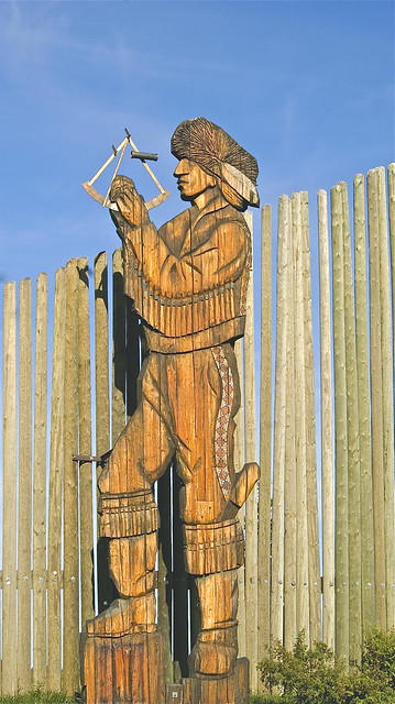
- Quote and photograph courtesy of SHAKA TRIBE. The Art of Polynesian Navigation: Exploring Ancient Seafaring Techniques[↩]
- This map is courtesy of Judith Beattie. 1985. “Indian Maps in the Hudson’s Bay Company Archives: A Comparison of Five Area Maps Recorded by Peter Fidler, 1801 -1802.” Archivaria.[↩]
- Source: HBCA E.3/2. fos. 106d-07; HBCA B.39/a/2 fo. 92d; HBCA B.39/a/2 fos. 85d-86. The bottom three modern renditions of these maps are from our book.[↩]
- Eleanor A. Maguire, Katherine Woollett, and Hugo J. Spiers, “London Taxi Drivers and Bus Drivers: A Structural MRI and Neuropsychological Analysis,” Hippocampus 16, no. 12 (December 1, 2006): 1091–101, doi.org/10.1002/hipo.20233.[↩]
- Even with modern GPS, the tests are still required. Known as “The Knowledge” test, requiring memorization of over 25,000 streets and landmarks, taking years to finish[↩]
- Although there is no scientific evidence to prove this, I have wondered whether the hippocampus of pre-GPS Venetians was larger than the average Italian hippocampus.[↩]
- M. R. O’Connor. Wayfinding. The Science and Mystery of How Humans Navigate the World. p.30.[↩]
- The core of this idea comes from the French sociologist, Pierre Bourdieu.[↩]
- Which begs the question: if you can’t read a map to help find your destination, how would you ever navigate and find you way without one?[↩]
- From: “Lecture 2 – Can you trust your memories?” Quizlet. https://quizlet.com/gb/325532459/lecture-2-can-you-trust-your-memories-flash-cards/[↩]
- Here is an excerpt from O’Connor about Australian Aboriginal oral history: “But even the most conservative estimate makes Aboriginal oral history the oldest in the world. Until very recently, there was a consensus that the longest time period that human memories can be transmitted between generations before their meaning has completely changed or become obscured from the original is five hundred to eight hundred years. But in 2016, two Australian researchers published a paper in the journal Australian Geographer that upended this idea. Patrick Nunn and Nicholas Reid recorded stories from twenty-one locations around coastal Australia, from the Gulf of Carpentaria in the north to Kangaroo Island in the south. In each place they found stories about a time when parts of the coastline now under the ocean were actually dry land. The researchers matched the stories to geological evidence of post-glacial sea-level rise. It seems that these stories have been repeated from one generation to the next for a minimum of seven thousand years, but possibly for as long as thirteen thousand years and represent “some of the world’s earliest extant human memories.” Nunn and Reid explain these nearly unbelievable figures by pointing to several characteristics of Aboriginal culture that elucidate how such a faithful oral transmission was made possible. They point to the great value Aboriginal people place on precision in telling stories “right.”[↩]
- Hercus, Luise, Jane Simpson, and Flavia Hodges. The Land Is a Map: Placenames of Indigenous Origin in Australia. Canberra: ANU Press, 2009. http://www.oapen.org/search?identifier=459353.[↩]
- https://pawneeland.wordpress.com/2016/11/13/the-moon-magic/ “…a Skidi [Pawnee] man called Taihipirus had been blessed by Spider Woman as a youth, and he had grown up with “womanish ways.” Becoming respected as a war leader, he took an expedition into the south of Pawneeland and there they were driven onto Pawnee Rock by a vast coalition of “ten or eleven tribes” who encamped around the hill….The Skidis endured great thirst, and one night Taihipirus received a vision from Spider Woman. He watched her come down her rope from the moon, and she told him about a “great rock” that could be moved to one of the sheer edges of the hill. Following Spider Woman’s instructions, Taihipirus and his companions escaped by tying together their ropes and attaching them to the stone.” From: A narrative of the Pawnee Buttes told by Roaming Scout. This version was written in Pawneeland. History of the Pawnee Nation and Beyond. . The Moon Magic.[↩]
- The Story Behind Aboriginal Body Art. Posted by Mbantua Gallery on 2021 Mar 08th. (https://mbantua.com.au/aboriginal-art-blog/the-story-behind-aboriginal-body-art/?srsltid=AfmBOoqlPeVFE-WSbZHvNNHlC2KIeHADuqFLC1eJ7vuKyNCMWXh3hsUj[↩]
- From: Seeing the Inside: Bark Painting in Western Arnhem Land. 1996. Clarendon Press, Oxford.[↩]
- Anthropologist Thomas Widlok experimented to determine the accuracy of Kalahari Bushmen navigation. In O’Connor’s own words:“The Hai||om, a group of about fifteen thousand people living in the Kalahari Basin, and other San groups had a reputation for nearly mythical powers of navigation. Widlok had read the literature documenting these skills. One hunter claimed that his San guide’s sense of direction was better than his handheld GPS device. Widlok also knew that during the border war in Angola and northern Namibia in the mid-twentieth century, the South African Army had created what was an elaborate ideology around these skills and exploited them to track down their enemies in the bush. Widlok knew from his experience that the Hai||om could accomplish orientation tasks that seemed impossible to him, such as easily locating places they had never been before. But how much did the language of the Hai||om play a role in these skills? Widlok took a GPS to the Mangetti-West region and began a study, accompanying six men, three women, and a twelve-year-old boy into the savanna, walking anywhere from nine to twenty-five miles. Widlok asked them to point to twenty different places ranging from a mile to over a hundred miles away. The visibility across the bush was around twenty yards, and there were no landmarks to be seen. Show me where X is from here, Widlok would ask, and then he noted the direction they pointed in and compared their estimates to his GPS reading. Again and again, Widlok found that the Hai||om’s dead reckoning skills were statistically barely different from the Guugu Yimithirr study group.” From: O’Connor, p.110[↩]
- Photograph courtesy of Margaret Kennedy and Brian Reeves. From: “Stone Feature Types as Observed at Ceremonial Site Complexes on the Lower Red Deer and the Forks of the Red Deer and South Saskatchewan Rivers with Ethnohistorical Discussion.”[↩]
- Norman Henderson. 1994. “Replicating Dog Travois Travel on the Northern Plains.” Plains Anthropologist Vol. 39, No. 148:145-159.[↩]
- Oxford Dictionary[↩]
- Even by the turn of the 19th century, Western maps such as Aaron Arrowsmith’s were not entirely accurate. While the latitude of landforms was relatively accurate, their longitude was often not very reliable.[↩]
- At the annual 2024 Plains Anthropology Conference, held in Lethbridge, Alberta, Canada, Dr. Gerry Oetelaar from the University of Calgary argued that parts of the Ak Ko Wee Ak map were a metaphor for a tipi. He suggested that the rivers represented the lodge’s poles and not just as a purely locational map.[↩]
- From: IDR News. “This Ancient Native American Star Chart Holds a Mysterious Secret That Has Experts Stumped.” https://indiandefencereview.com/this-ancient-native-american-star-chart-holds-a-mysterious-secret-that-has-experts-stumped/[↩]
- “Oral tradition as emplacement: Ancestral Blackfoot memories of the Rocky Mountain Front.” Journal of Social Archaeology. June 2021: Maria Nieves Zedeno, Evelyn Pickering, and Francois Lanoe[↩]
- From: “Oral tradition as emplacement: Ancestral Blackfoot memories of the Rocky Mountain Front.” Journal of Social Archaeology. June 2021: Maria Nieves Zedeno, Evelyn Pickering, and Francois Lanoe[↩]
- Low lying landforms like lakes are poor navigational devices because they are not easily visible from a distance.[↩]
- From: Mirau, N. and D. First Rider. 2009. South Saskatchewan Regional Plan (SSRP) Traditional Use Studies Project. Prepared for Alberta Environment, Lethbridge, Alberta[↩]
- From: The Blackfoot Confederacy Nations of Alberta in association with Arrow Archaeology Limited. December 2017. Traditional Use Studies Project. Prepared for Alberta Environment, Lethbridge, Alberta[↩]
- For more on this subject, readers should refer to: “Oral tradition as emplacement: Ancestral Blackfoot memories of the Rocky Mountain Front.” Journal of Social Archaeology. June 2021: Maria Nieves Zedeno, Evelyn Pickering, and Francois Lanoe[↩]
- Indigenous Napi story first recorded by Grinnell GB. 1962. Blackfoot Lodge Tales. Lincoln: University of Nebraska Press.[↩]
- Blackfoot language (Siksikaitsitapi) is highly descriptive, allowing speakers to visualize concepts. It also encodes rich cultural values, relationships, and detailed environmental observations, often creating imagery that English translations can’t capture. It’s an action-based language with unique grammar that reflects the worldviews and history of the Niitsitapi (Blackfoot people.[↩]
- From: O’Connor, p.64-65[↩]
- I have always felt, but can’t prove it, that referring to many buffalo names and parts of the animal across the parkland-prairie transition is symbolic of the many bison herds that would have journeyed to the Alberta parklands during certain times of the year.[↩]
- From: Cartographic Poetry. Examining Historic Blackfoot and Gros Ventre Maps. Ted Binnema, Francois Lanoe, Heinz W. Pyszczyk. 2025. University of Alberta Press.[↩][↩]
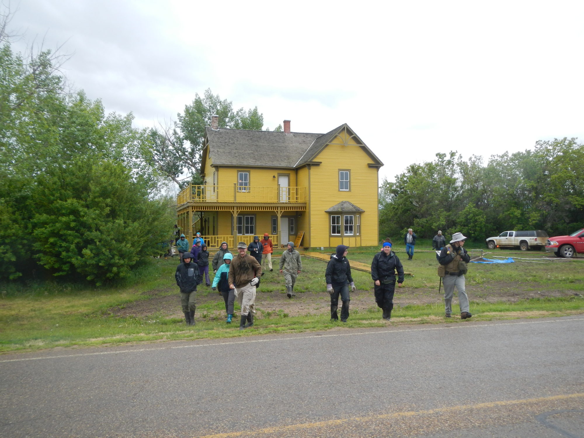
- For more information regarding our search for this fort(s), refer to: Heinz W. Pyszczyk and Gabriella Prager. 2023. “Peter Fidler’s Long Lost Chesterfield House: Have We Finally Found It?” In Saskatchewan Archaeology Quarterly. Volume 7:60-67.[↩]
- Because of terrain dead reckoning to many destinations would have been impractical if not impossible. For example, Ki oo cus would have had to cross major rivers and streams along most of the routes. His band could only cross them at certain spots. They needed to maintain a certain direction along their route to do so.[↩]
- The other possible explanation may relate to how the Blackfoot travelled from Chesterfield House to each of these opposite destinations. Did one group travel with only warriors by horse to the Judith Mountains? Did the other group travel to the Buffalo Nose with the entire band?[↩]
- If I’m given a distance to a destination, the first thing I would ask is how long it would take to get there.[↩]
- From: John L. Allen. Indian Maps. https://lewis-clark.org/sciences/geography/mapping-unknown-lands/Indian-spatial-concepts/[↩]
- Indian Maps. https://lewis-clark.org/sciences/geography/mapping-unknown-lands/indian-spatial-concepts/[↩]
- From: Jolynn Parenteau. 2023. “Miywasin Moment: Guiding Lights.” Medicine Hat News.[↩]
- The size of people’s fists is roughly proportional to the length of their arms. A child with a small fist and small arm will measure approximately 10 degrees. An adult with a larger fist and longer arm also measures 10 degrees from their point of view.[↩]
- Could you sit down and draw the directions of places familiar to you, relative to one another, more accurately? Probably not, but you still would find those places while navigating your landscape. The locational inaccuracies on the map doesn’t necessarily equate to a poor knowledge of those places when navigating.[↩]
- We still do this to some extent in our modern world, but less and less so. Whenever you take a walking tour through an unfamiliar city or landscape, your guide will point out certain places and tell stories about them. As I walk past the old Clarke Stadium grounds in Edmonton, Alberta, I share stories with others, how the great quarterback Warren Moon, then playing with the Edmonton Eskimos, lit up visiting teams in the Canadian Football League at this particular place.[↩]


